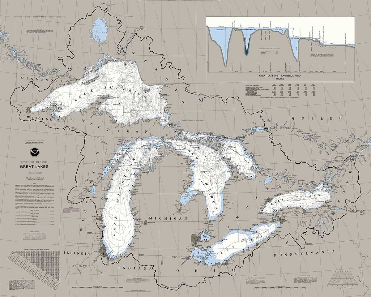
“Great Lakes” is a reproduction of a traditional nautical chart. In simple terms, a nautical chart is a map which covers an area of water and adjacent coastlines. These have been used for centuries by mariners for navigation. The Great Lakes consist of Lakes Superior, Michigan, Huron, Erie, and Ontario. Located in the US and Canada, they form the largest group of freshwater lakes on Earth, containing 21% of the world’s surface fresh water. Lake Superior is the second largest lake in the world by area, and Lake Michigan is the largest lake that is entirely within one country. The total surface area is 94,250 square miles. The Great Lakes region has a total population of over 30 million. Due to their sea-like characteristics, the Great Lakes have long been referred to as inland seas. They connect to the Atlantic Ocean through the Saint Lawrence River. 1,000 piece jigsaw puzzle.
Heritage Puzzles boasts a full repertoire of puzzles from incredible artists and photographers. Our collection includes original artwork and one-of-a-kind prints that once completed, are works of art perfect for display in your home.
UPC: 654497207017
Weight: 27.30 ounces
Jigsaw Pieces: 1000
For Ages: 11+